After ending my hike prematurely last year, I finally returned to the Superior Hiking Trail to finish the last fifty miles of my thru-hike.
Last year I began my SHT thru-hike at the southern terminus just south of Duluth, Minnesota. Over the next 11 days I hiked 233 miles north to Grand Marais. My quick pace resulted in countless blisters and I was forced to leave the trail before finishing. Now a year later, I got back on the SHT to finish what I’d started.
VIDEO
DAY 1
My dad and I drove from Duluth to Grand Marais where my uncle lives. The three of us didn’t waste any time and headed to the carpark for Pincushion Mountain where I had ended my hike last year. From here it was a very pleasant stroll through boardwalks and beautiful forests until we took a spur trail to the overlook of Pincushion Mountain.


The trail continued down into the valley of the Devil Track River where we eventually crossed the waterway. There were two great campsites on either side of the river but I wasn’t ready to end the day and carried on. We encountered a mother taking her teenage son on his first backpacking trip but their packs looked extremely heavy. The woman admitted to carrying way too much which might explain the less-than-enthused look on her son’s face.


We headed steeply out of the ravine and after a total of five miles, we reached the road crossing where we had planted a car earlier. I had been slack packing (hiking sans backpack) up to this point and now retrieved my pack from the car. My gear was pretty much the same as a year ago and I threw on my pack, said goodbye to my family, and headed into the woods.


With only an hour and a half of daylight, I quickened my pace and pushed 2.5 miles to Durfee Camp. I had left the easy trail of Pincushion Mountain behind, where day hikers abound. The trail now became full of roots and rocks with overgrown bits. Someone had come by recently and weed-whacked sections which helped, but the debris still littered the trail. Upon reaching camp, I realized there was another camp 1.5 miles further, and with a sliver of daylight left, I pushed on. Reaching Cliff Creek Camp, I met a fellow section hiker in his late forties. We chatted a bit while I scrambled to erect my tent and cook dinner as dusk fell.
Daily Mileage: 8.7 miles
Total Part 2 Mileage: 8.7 miles
Total SHT Mileage: 241.4 miles
DAY 2
Today was the big push. I planned to hike as far as I could so that I could finish the hike the following day. I packed up and soon caught up with Sean, the section hiker I’d shared camp with. We hiked together for a hour before he reached his car. He was slowly hiking the entire trail in small sections so that he could thru-hike its entirety when he turned fifty. He gave me some fresh water to refill my cache before I headed off on my own.

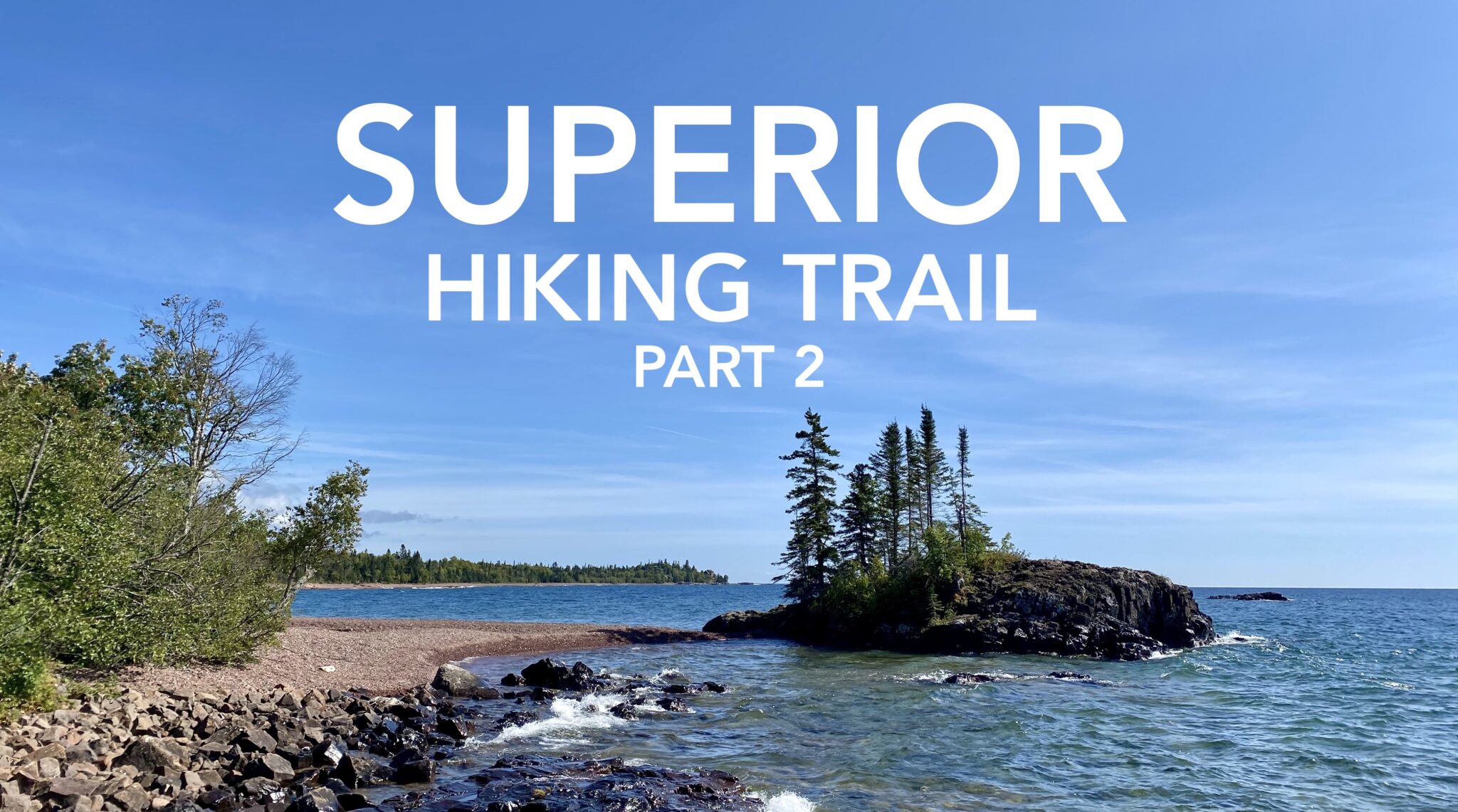
The trail wasn’t too bad and I quickly found myself face to face with Lake Superior for the first time on my entire SHT hike. I walked onto a pebbled beach and touched the frigid waters. For one and a half beautiful miles I walked the shoreline while waves crashed and the sun beamed down. I saw several SOBO (southbound) hikers relaxing on the shore. At the end of the beach walk was a little tiny island/peninsula jutting out and I climbed to the edge and had lunch with a waterside view. As I left the beach, I crossed a boardwalk where a sign indicated the lowest point on the SHT.


I reentered the woods and the trail traveled through private land before arriving at Judge C. R. Magney State Park. I filled up on water from their tap and crossed the Brule River. My feet were very sore from all the miles, but I had more to walk. The trail had me climbing up and down long staircases before I reached Devil’s Kettle Falls. This unique waterfall features a fork above the falls where part of the flow falls into a giant cauldron of rock and seemingly disappears. To this day scientists aren’t entirely sure where the water goes, but theorize that it travels underground before somehow rejoining the river downstream.

After the falls I continued following the Brule River. A sign warned of closed trail ahead except for thru-hikers; I felt so VIP. The trail had been washed out during the spring floods and new trail had not been blazed yet. There were many downed trees and the banks were eroded in many places. A temporary trail had been cut along the river and I briefly got lost in the debris of fallen trees and brush, having to spend a few minutes searching for the trail. Eventually, the trail headed steeply away from the river and joined a road.

The easy road walk had me cruising along, making good time. Then the trail became tedious with rocks, bushes, and tall grass. And then another road walk before climbing back into the forest. On these last few miles I was starting to fall apart. Though Day 1 had been an easy day, my big push today had taken its toll. But I knew it was all worth it, for the farther I went today, the less I had to hike in the morning.
I stopped to grab water from Carlson Creek before camp. A large beaver lodge resided just upstream so I filtered the water and the chemically treated it as well, just in case. At camp I met a SOBO hiker and we chatted over dinner. That night it rained for the first time on my entire hike, including last year. My tent was five years old and I’d used it on my Appalachian Trail thru-hike as well as New Zealand’s Te Araroa. During the latter trek, the tent had began to leak. Since then, I’d applied a chemical product to re-waterproof the tent but had yet to test it out in the field. Fingers crossed I’d stay dry through the night.
Daily Mileage: 24.5 miles
Total Part 2 Mileage: 33.2 miles
Total SHT Mileage: 265.9 miles

DAY 3
My tent repairs ultimately proved futile as water dripped onto my face. Oh well, it had served me well on three thru-hikes over five years. It had rained all night and started again just as I was about to pack up. I lay in my tent for an extra hour until it stopped. The rain had ushered in a foggy and misty morning as I left camp at 9am, a late start. I passed a number of SOBOs who were friendly to meet.


There were no views as I hiked through the fog and soon reached the highest point on the SHT where I couldn’t see a thing. The trail was littered with wooden plank walkways, but the rain had made them extremely slippery and I nearly fell a number of times.


I found a water filter lying in the trail, having fallen out of someone’s pack. My heart sank for whomever it belonged to; I couldn’t imagine losing a filter. As I picked it up, a SOBO came along and I asked if she had seen anyone else heading north. She said no, so I figured the filter must belong to one of the SOBOs I had passed earlier. I handed it to her in hopes she might catch up with its owner.

Despite everything I had read about lack of cell reception, I had service for most of the day and was able to keep in touch with my dad and uncle. I updated them on my remaining miles, as we had arranged to meet near the trail’s end. The sun slowly came out as I encountered overgrown sections of trail, unable to see my feet amidst the tall grasses.

At last I reached the parking area at the Otter Lake Road trailhead where my dad and uncle were waiting. This carpark is also where the Border Route Trail begins, sharing this last bit of of the SHT. I ditched my pack in the car and we set off together to tackle the final mile of trail. The sun had burned away the fog and the climb was rather easy. As we hiked, we encountered the turnoff where the Border Route Trail and North Country Trail leave the SHT and continue west, all the way to North Dakota for the latter.

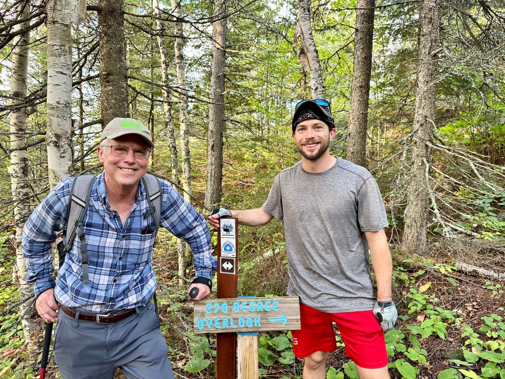
Finally we reached the 270 Degree Overlook, the northern terminus of the Superior Hiking Trail. We were afforded fantastic views of the surrounding wilderness, looking out across the Pigeon River with Canada on the opposite bank. The vista was worth it and my thru-hike was finished! Now we had to hike a bonus mile to get back down and return to the car.


To celebrate my achievement, we headed back to Grand Marais for a hot shower and dinner with family. The following day we toured around town a bit more and enjoyed the delightful weather. And now having learned about the Border Route Trail, my interest was piqued. Maybe next year? And for more information about my complete SHT thru-hike, be sure to check out my gear list and part one.
Daily Mileage: 17.1 miles
Total Part 2 Mileage: 50.3 miles
Total SHT Mileage: 283 miles


From apparel to prints, grab some awesome trail merch at the A Stray Life Shop!
To follow along with my adventures, sign up via email below or like/follow on Facebook, Instagram, and YouTube:

Leave a Reply