Your cart is currently empty!
Te Araroa 21: Waiau Pass

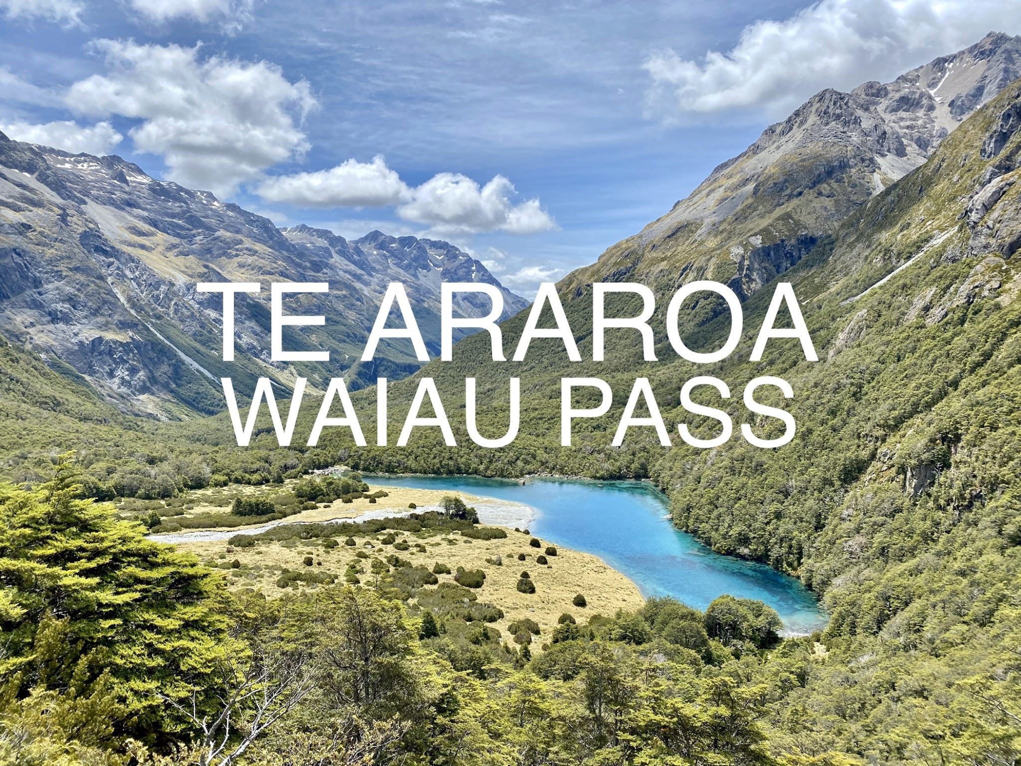
Waiau Pass is by far my favorite section of the Te Araroa with its stunning beauty and challenging terrain.
If you missed it, here’s the last post as well as all the previous blogs from the trail.
VIDEO
My favorite two days on trail, there was endless beauty to be had.
DAY 62 – St. Arnaud to Upper Travers Hut
It was a hot night in the room at the hostel. I tried to sleep in as best I could. Later I had breakfast at the lodge restaurant. It was an overpriced buffet but I needed as much food as I could get. This next section is the Waiau Pass, a high alpine crossing over a high saddle and then a mountain pass. I won’t be able to get more food for quite some time and I was a bit worried that my resupply was meager compared to the difficult terrain ahead. The difficulty of the South Island has slowed my pace quite a bit.
I hiked out of St. Arnaud and into Nelson Lakes National Park. An Italian hiker named Roberto joined me and we walked along the shore of Lake Rotoiti. We stopped at the pier where everyone takes their classic Nelson Lakes photo. I’d been here before but not on such a windy day.

We were trying to get to the third hut down the track since so many hikers had bottle-necked into St. Arnaud and would be setting out today. The route was also shared with the Travers-Sabine Crossing so it was popular with a lot of non-TA hikers.

Hiking in the woods along the lake was beautiful. We stopped at a dock where black swans swam and we debated going for a swim. Ultimately we decided it was too cold and the sand flies were hanging about.

Roberto was nice company. He told me he would never hike as far as I was planning to go today so it was good that I was there to push him. Without Tom, I’d been on my own which is fine. But these brief moments where I can hike with someone else and have a chat is a nice change from the solitude. It’s just sad that I’m usually faster than everyone I meet so the company is always short-lived. I suppose without Tom I could slow down but I still would like to go farther.

In fact, Tom is still in New Zealand driving around in a rental car exploring. If I finish the trail within his same timeframe we might be able to do some other hikes together. Last I heard, he was following in my footsteps and set off to hike up Tapuae-O-Uenuku.

The trail was absolutely stunning today. We followed the Travers River with sweeping views of the mountains all around. There was even snow on some of them. It was incredible.


We stopped for lunch at the second hut on the trail and ran into a few other hikers. It seems the trail was busy and there were others ahead of us, all hoping to get to the same hut.


I hiked on ahead of Roberto as he was slowing down a bit. This would be his biggest day on the trail. Soon I passed a quick detour to Traverse Falls. I was tempted for a dip but it looked freezing!


At last I reached the Upper Travers Hut. The hut was high up the valley, surrounded by mountains. Perhaps the best view from a hut. It could fit 24 and it seemed it would be full tonight.

I claimed a bunk immediately and then relaxed in the common area. It was only 6pm with three more hours of daylight. I would have hiked on farther but the next hut was on the other side of the Travers Saddle. Everyone was waiting until morning for the big climb and then going to the same hut before the giant Waiau Pass climb. With the weather forecast, I wanted to do both climbs, the saddle and the pass, the following day. It was only 15km but the guide said it could take 20 hours to do both…yikes!

Roberto ended up making it to the hut and we had dinner with fellow TA hiker, Rowan. The latter was a young Kiwi and had brought his ukelele on the trail. At dinner he also whipped out a chess board and I watched a rousing game between he and Roberto. Again, the company was nice for a change.

At last we all went to bed in the crowded bunk room. I knew it wouldn’t be a great sleep before my big day tomorrow. Oh, well. At least today had been fantastic!
Day’s Distance: 29.5km (18.3mi)
Total Distance: 1,974.5 (1,227.2mi)
Distance Remaining: 1,025.5km (637.4mi)
DAY 63 – Upper Travers Hut to Caroline Bivvy
The hut was bustling when I got up. Everyone was having breakfast which I always skip so I was quick to leave. I said goodbye to Roberto as I would probably not see him again. Rowan left with me, wanting to try and push hard with me.


It was very cold outside but a big climb was ahead to warm us up. We began the 450m (1,475ft) ascent of Travers Saddle up to 1,787m (5,863ft). It was grueling but the frigid air and fresh legs made it rather easy.


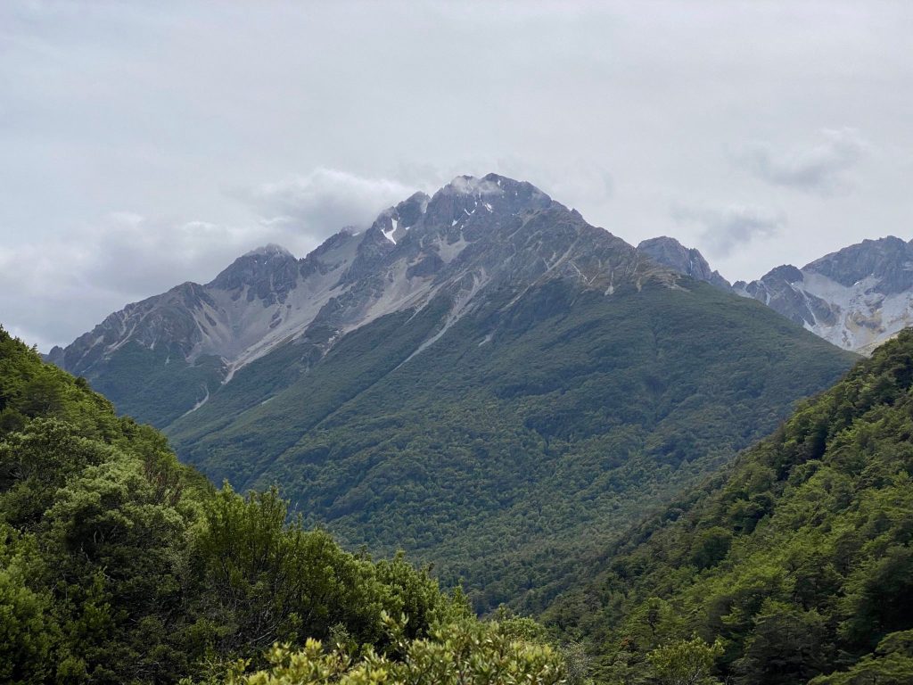
The views were incredible. The mountains surrounded us with Mount Travers towering above us. I couldn’t get enough of the view.


We were really out in the wilderness. There was nothing but mountains and valleys as far as the eye could see. Simply incredible.


The descent was a bit tricky. It was hard on the knees and then we reached a rock slide. We had to figure our own route down because there were no markers. Every winter, avalanches and heavy rains would push all the rocks down and change the terrain. We picked across the rocks slowly.


At the bottom we followed the east branch of the Sabine River into the forest. It was crazy to think that we hiked from the source of the river at the top of the mountain and were now watching as the river grew bigger and bigger.


I got ahead of Rowan as he couldn’t keep up with my pace. I’d planned a big day to beat the inclement weather coming in the next few days. And because I don’t have that much food. And because I just hike too much and don’t know how to relax and take it easy. Anyway, I planned to hike over Travers Saddle and then hike to Blue Lake and then over Waiau Pass. Distance-wise this wasn’t a huge amount but the guide said to break it up into multiple days and that it’s extremely grueling. People at the hut last night thought I was crazy to attempt such a feat. They wanted me to write in the hut logbooks if I succeeded in my task so they’d know!

Near the Sabine Hut, the river had flooded onto the trail. It hasn’t rained lately but the river was strong. I stopped at the hut for a quick snack.


The next section of trail had been devastated by heavy rains in December. Trees were knocked over everywhere and the river had completely changed course. The trail was gone and a temporary reroute was attempted.


I got lost a few times looking for the new trail and ended up bush bashing through the woods at one point. It was quite the struggle as I climbed up and over steep rock slides and around areas the river had cut through. It was tedious and taking up valuable time. I was, however, in awe of the power of nature and the river.


Eventually I followed the west branch of the Sabine River toward its source. The trail opened up into a valley with waterfalls and mountains all around. It was magnificent.


Slowly I climbed up to Blue Lake Hut. I sat and had lunch inside before setting off, passing the aptly named Blue Lake. The lake isn’t very deep but it’s known for being the clearest freshwater on Earth. They measured the visibility of the water and nowhere else in nature is there clearer freshwater that scientists know of. They could see underwater for 80m (262ft). Pretty neat.

From the lake I climbed up to Lake Constance. On the way I got lost again, looking for rock cairns in a sea of rocks. I scaled a steep bluff that was not the trail but eventually made it to the trail. This day had all sorts of challenges. But the views looking down on Blue Lake were spectacular. I can’t emphasize enough how amazing the views were throughout the day; nonstop gold.


Lake Constance was a much larger lake, and the source of Blue Lake’s clear water. Glaciers had left a moraine that dammed up the water, creating Lake Constance. The water then seeps through the rocks of the moraine and is filtered amazingly well, making Blue Lake so clear.


I continued along the shore of Lake Constance for quite a ways. I was tempted to swim but the alpine breeze did not compliment the water temperature.


At the lake head I followed the mountain stream along a flat open valley. The mountains formed a horseshoe leaving me at a dead end. This was Waiau Pass.

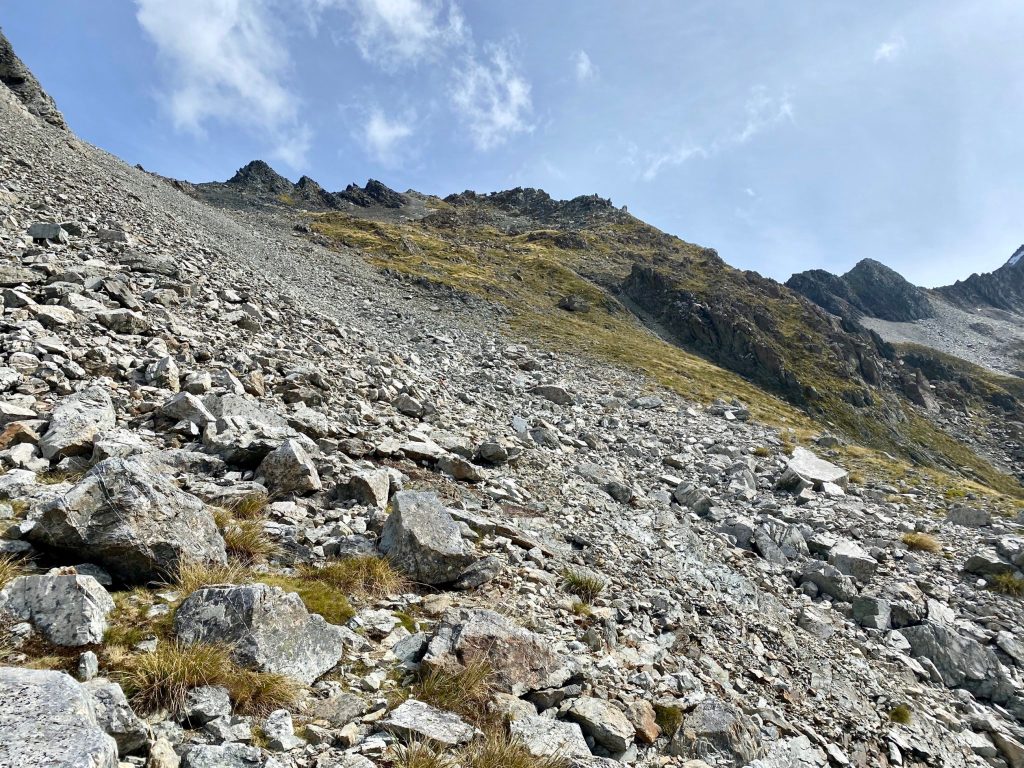
A daunting field of rock scree stretched into the heavens. It was beautiful but I wasn’t looking forward to the climb.

At 1,870m (6,135ft), Waiau Pass is the second highest point on the TA. I took short breaks constantly as I climbed. It was straight up the mountain with no switchbacks. I had to pay attention to my footing because the loose scree could take me all the way back to the valley floor.

I was glad that I’d pushed on because the weather was perfect. Rain was forecast for the next few days which would ruin the views, make for slippery and dangerous climbing, and also be extremely cold at this altitude.

I started celebrating when I reached the top, only to discover it was just a terrace and that I was only maybe halfway or so.

I followed the terrace to another scree slope and began the final ascent. Again, the views were out of this world. I felt like my life was a National Geographic pictorial.


As I reached the top of the pass, it was like opening the door to a whole new world. I was leaving one valley and entering an entirely new one. More mountains all around, but ones I’d not see yet. And snow!


The sun was shining but I knew I still had a ways to go. I was high in the sky and the valley floor was so far below.

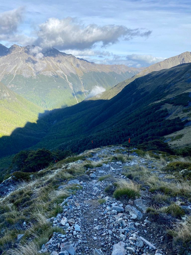
The descent proved extremely tedious and technically challenging. It was steep and the terrain very rocky and jagged at times. My knees were so sore.

I felt this was the most technically difficult section of the TA. It wasn’t as physically demanding as the climbing but it was exhausting picking my way down the mountain. Oh, my poor knees.

As I slowly lowered myself into this new world, I thought about how much I miss home. This trail has been amazing as well as my time in New Zealand but I was ready to go home and see all my family and friends. I also thought about all the food I missed from home.

Eventually the descent became more gradual and I followed the Waiau River as it grew. There were more rock fields to pick around and the river at times forced me to reroute around it. But I was in the homestretch.

As the trail became easier and started opening up into large grassy fields, I passed the 2,000km mark. I had officially completed two-thirds of the trail! 1,000km to Bluff!

Just as I was about to reach the Caroline Bivvy, I had one last stream to cross. All day I’d been crossing streams and parts of rivers and managed to keep my feet dry. This stream wasn’t even big but it was so fast there was no way to cross without getting wet. Not wanting to wet my shoes and socks at the end of the day, I switched to sandals as the sand flies attacked.

The water was frigid and I didn’t bother putting my shoes back on. The shelter was so close. When I arrived, the bivvy was underwhelming. It was a tiny hut with two sagging bunks covered in filth. I’d have to be so desperate in a blizzard with hypothermia to want to sleep inside.

A brand new shelter was 3km away but I was so exhausted already from the day. I had climbed two huge mountain passes against the odds. It was 8pm and it would be dark by the time I reached the next shelter and it could be full. So for once I decided not to keep pushing and just rest.

The sand flies feasted on me as I set up my tent. I threw all my stuff inside and quickly jumped in. I’ve never seen so many sand flies. I was starving from my big day so I treated myself to three ramen noodle packs instead of the normal two. I know I’m not eating enough but my next resupply isn’t for a long way so I have to ration what I have.
All in all, this was an incredible day. So much happened it feels like a weeks worth of excitement! And I really and truly am out in the bush now. There is only wilderness all around. It’s exciting and a bit scary how remote it is out here.
Day’s Distance: 28.5km (17.7mi)
Total Distance: 2,003 (1,244.9mi)
Distance Remaining: 997km (619.6mi)

Shop Te Araroa Merchandise
From apparel to prints, grab some awesome trail merch at the A Stray Life Shop!
To follow along with my adventures, sign up via email below or like/follow on Facebook, Instagram, and YouTube:
Comments
2 responses to “Te Araroa 21: Waiau Pass”
I’m loving reading your blog. Keep it up. The Te Araroa is definitely something I’m planning on doing in a couple of years. Got to mend my broken leg & get fit again. In the meantime loving your updates. Enjoy the journey, love the views and keep smiling. 😀
Thank you! I appreciate that! It’s quite an adventure. I definitely would recommend the South Island but I wish I hitched on the North!

Leave a Reply